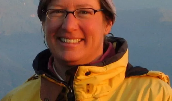
Risky Science at the Top of the World
Anne Sheehan is a professor of geology at the University of Colorado at Boulder and a scientist with the Cooperative Institute for Research in Environmental Sciences (CIRES). In this interview for Behind the Scenes, she recounts the obstacles she faced in September 2001. Just weeks after the 9/11 terrorist attacks, she traveled to Nepal--a state that was in political turmoil--to map geologic structures deep below the "roof of the world."
On June 1, 2001, the Nepalese Royal family was murdered. Three months later, the 9/11 attacks occurred. What was it like traveling to Nepal on Sept. 30?
Just getting on the plane was kind of scary. In addition to the Nepalese royal family being massacred, there had been a ramp up in the Maoist rebellion in Nepal. And then with 9/11, there was a lot of concern just about being stranded in different places.
Some of the technicians who were planning to come along cancelled at the last minute. And I had to decide whether to go ahead and have the seismic equipment shipped. Once it's shipped, you pretty much have to go to be there when it arrives.
I talked with colleagues and people who had worked in Nepal and others to get their advice. Finally, when departure day arrived, I remember going to the Denver airport and thinking that if either of the two post-docs who were going with me had not shown up, I probably would not have gotten on the plane.
What first attracted you to Himalayan geology?
Studying the Himalaya is really exciting because the mountains are still actively forming. The Indian continent is still pushing into Asia at a rate of 4 centimeters a year.
To study the mountains, I use seismometers--instruments that record waves that travel through the earth after an earthquake--to explain how the collision and rock folding is taking place, not at the surface but deep below the surface. When you can see the faults and the subsurface, you can get an idea of where the weak zones are and in what way, or direction, an earthquake is likely to rupture.
The Himalaya include the tallest mountains in the world, including Mount Everest, which is 29,029 feet high. How did these mountains form?
The Himalaya are the product of the collision of the Indian continent into Asia over the past 50 million years or so. During the collision, the northern part of the Indian continent has crumpled up, folding the rock layers to make the Himalaya mountains. The ocean between India and Asia was squeezed away in the crumpling, so we now have seafloor rocks on the top of Mount Everest and in other high parts of the Himalaya.
What were your first impressions upon arriving in Katmandu?
Once we got to Nepal, everything was really fine. It was a bit of a culture shock--all the noise and activity--but after a day or two, we went to the U.S. embassy to check in and get some advice on the security situation, and there was this huge pile of prayer scarves, and drawings and cards made by school children, that the Nepalese had left to express their sympathy about the 9/11 incident. So in some sense, it was a good time to travel because there was a lot of sympathy toward Americans . . . I felt very much at ease once we got there and got to work.
Tell me about the people you met and traveled with in Nepal.
We worked with Nepalis from the Department of Mines and Geology and also with Nepalis from a trekking company that helped with our logistics. The Nepalis from the trekking company were all Sherpa, so they were from a slightly different culture than the scientists, who were all Hindu. Having both travel with us was really helpful because no matter where we went, one or the other could help translate or introduce us to someone they knew.
How important was that?
It made the trip a lot easier. Getting around Nepal can take a long time, just getting plane tickets or getting things shipped. And in terms of getting permission to place a seismic station on someone's land, you had to make a friend and get them to agree to host the site and take care of it.
Some of your field stations were in fairly remote locations. How did you access them?
We flew to a lot of stations, so they were in places that had a small airport that was open just a few months out of the year. These airports are tiny little airstrips on terraces or ridges where there's not much room for error. And in the Himalaya, they fly by sight, and the mountains are all around. So that was something I had been nervous about.
Did you face any challenges from the natural environment?
At one of the sites, near Biratnagar, the mound (housing our seismometer) became very popular with local cobras, because it was the highest thing around and they could make a nest where their offspring wouldn't drown. Another site was essentially infested by scorpions that liked having a dark, protected area to hide.
What's next for you?
In the United States, I have a GPS study of the Rio Grande Rift, which is an unusual thinning in the earth's surface. Rifts usually form along mid-ocean ridges, not in the middle of continents. We want to understand if the Rocky Mountains are being pushed up or pulled down as the rift stretches apart.
-- Adriana Bailey, CIRES, (303) 492-6289 news@cires
This Behind the Scenes article was provided to LiveScience in partnership with the National Science Foundation.


