
Multimedia Gallery

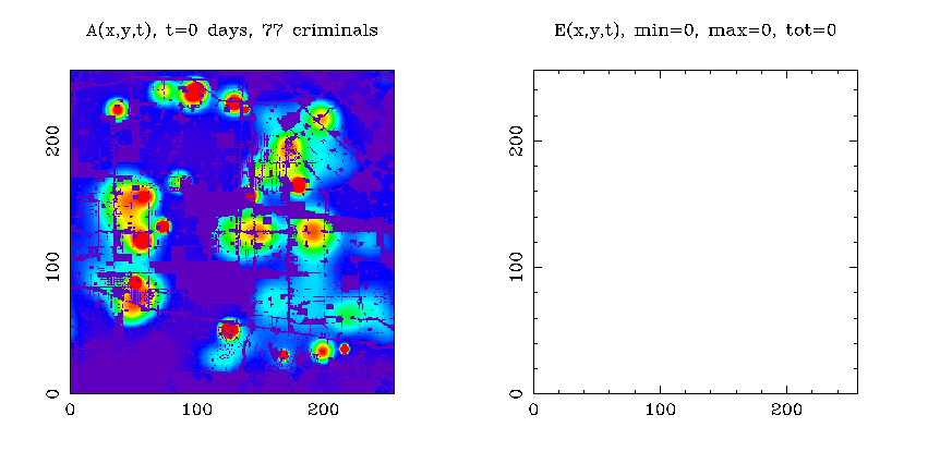
New mathematical models predict formation of crime hotspots and gives clues for police strategies.
Researchers at UCLA and University of California, Irvine say crime hotspots form in two ways--either when small spikes in crime grow and spread, or when a large spike in crime pulls offenders to a specific location. Shown here on the left is a two-dimensional discrete simulation of burglary hotspots in an 18 x 18 km. area of the San Fernando Valley, Los Angeles. On the right is a spatial distribution of crimes. The researchers teamed up with the Los Angeles Police Department to analyze burglaries over the last 10 years. Model parameters are calibrated against housing density, and the models factor in true and simulated crime events.
Credit: UC Mathematical and Simulation Modeling of Crime Project
Images credited to the National Science Foundation, a federal agency, are in the public domain. The images were created by employees of the United States Government as part of their official duties or prepared by contractors as "works for hire" for NSF. You may freely use NSF-credited images and, at your discretion, credit NSF with a "Courtesy: National Science Foundation" notation.
Additional information about general usage can be found in Conditions.
Also Available:
Download the high-resolution GIF version of the image. (7.2 MB)
Use your mouse to right-click (Mac users may need to Ctrl-click) the link above and choose the option that will save the file or target to your computer.
Related story: Fighting Crime With Math