
All Images
Research News
Study reveals America's most flood-vulnerable communities

New research shows the need for a more comprehensive understanding of inland flooding risks.
Credit: NOAA
Download the high-resolution JPG version of the image. (97.8 KB)
Use your mouse to right-click (Mac users may need to Ctrl-click) the link above and choose the option that will save the file or target to your computer.
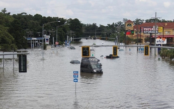
Floods in August of last year wreaked havoc throughout Baton Rouge, Louisiana.
Credit: NOAA
Download the high-resolution JPG version of the image. (412.3 KB)
Use your mouse to right-click (Mac users may need to Ctrl-click) the link above and choose the option that will save the file or target to your computer.
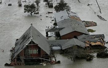
Cameron Parish in Louisiana has 93 percent of its population living in the flood zone.
Credit: NOAA
Download the high-resolution JPG version of the image. (32.7 KB)
Use your mouse to right-click (Mac users may need to Ctrl-click) the link above and choose the option that will save the file or target to your computer.

Natural "green barriers" help protect Florida infrastructure from severe storms and floods.
Credit: NOAA
Download the high-resolution JPG version of the image. (2.8 MB)
Use your mouse to right-click (Mac users may need to Ctrl-click) the link above and choose the option that will save the file or target to your computer.
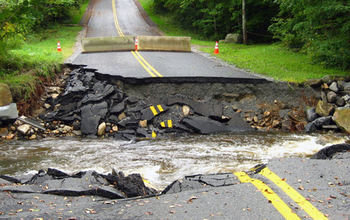
Extreme rainfall events may result in flood risks to infrastructure such as roads.
Credit: NOAA
Download the high-resolution JPG version of the image. (240.0 KB)
Use your mouse to right-click (Mac users may need to Ctrl-click) the link above and choose the option that will save the file or target to your computer.

A look into the past: a flooded Market Street in Galveston, Texas, after a 1915 hurricane.
Credit: NOAA
Download the high-resolution JPG version of the image. (50.3 KB)
Use your mouse to right-click (Mac users may need to Ctrl-click) the link above and choose the option that will save the file or target to your computer.