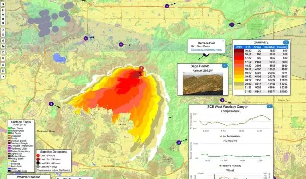
The race to stay ahead of wildfires
With the seemingly endless wildfire season gripping many parts of California, interest in the NSF-funded WIFIRE project has seen a sharp rise among the state’s disaster prevention authorities and other organizations.
A project developed by researchers at UC San Diego and other institutions, WIFIRE is improving the capability of western states to deal with wildfires.
"WIFIRE was created to integrate real-time information about wildfires and to use such information for predictive fire behavior modeling," says Ilkay Altintas, WIFIRE principal investigator.
Adds Neal Driscoll, a geoscientist at the Scripps Institution of Oceanography who is a WIFIRE collaborator, "Every fire starts out small. If we can get on top of it in its incipient phase, we have the opportunity to stay on offense. We're saving lives. That's the number one thing."
WIFIRE scientists aim to build a fleet of drones that can work in unison to map an area in real-time; monitor environmental conditions such as temperature, humidity, wind and air quality; and provide early warning to state foresters, fire departments and wildfire prevention agencies.
"WIFIRE is important for building advanced cyberinfrastructure that connects research results with actionable information that can be used by the wildfire management community in a timely manner," says Stefan Robila, a program director in NSF's Office of Advanced Cyberinfrastructure. "Advances in the integration of sensor observations with real-time monitoring, simulation and visualization, along with collaboration between wildfire researchers and practitioners, are prototypes for advanced hazard management infrastructure."
WIFIRE, he says, adds to the national data and software cyberinfrastructure that supports research vital to the country's ability to strengthen its resilience to hazards.


