
Multimedia Gallery
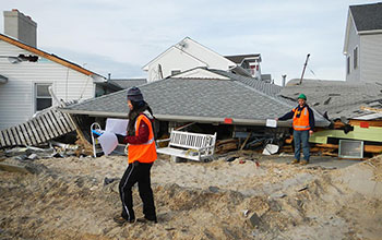
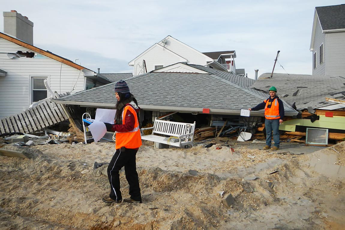
Houses damaged in New Jersey after Hurricane Sandy
Houses damaged at Ortley Beach, New Jersey, after Hurricane Sandy. Researchers at Princeton and Rutgers universities and the Woods Hole Oceanographic Institution have developed a computer simulation that estimates that storm-related flooding on the New York City coastline, similar in scale to what was seen during Sandy, is likely to become more common in coming decades.
More about this image
Researchers at Princeton and Rutgers universities and the Woods Hole Oceanographic Institution have developed a computer simulation that estimates that storm-related flooding on the New York City coastline similar in scale to what was seen during Sandy is likely to become more common in coming decades. The new model provides an important new tool that can predict--more accurately than previously possible--the kinds of storm floods that will threaten coastal cities over the next century. The new simulation promises to provide a picture of long-term coastal flood risk by accounting for both sea-level rise and varying storm activity due to climate change. Scientists call flooding associated with coastal storms "surge floods," referring to the rise of coastal water due to storm surge (produced by a storm’s pressure and wind forces) and sea-level rise.
In the study, Ning Lin, lead author of a paper published on the research and an assistant professor of civil and environmental engineering at Princeton, and colleagues used the model to estimate past and future Sandy-like flood events in New York City. Their estimates were based on historic data and combined predictions of sea level and peak storm-surge height generated by several climate models including those the National Oceanic and Atmospheric Administration uses.
"Our model for the first time pulls together probabilistic estimates for sea-level rise and storm surge to produce long-term predictions of flood stages," Lin said. "These two variables, although largely uncertain, are critical in determining the extent of coastal flooding from future hurricanes."
The research was supported in part by a National Science Foundation Rapid Response Research (RAPID) grant (CMMI 13-14649), awarded for research having a severe urgency with regard to the availability of or access to data, facilities or specialized equipment, including quick response research on natural and other disasters.
To learn more about this research, see the NSF News From the Field story Researchers predict growing number of Hurricane Sandy-like storm surges. (Date image taken: November 2012; date originally posted to NSF Multimedia Gallery: March 1, 2017)
Credit: Ning Lin, Princeton University
See other images like this on your iPhone or iPad download NSF Science Zone on the Apple App Store.
Images and other media in the National Science Foundation Multimedia Gallery are available for use in print and electronic material by NSF employees, members of the media, university staff, teachers and the general public. All media in the gallery are intended for personal, educational and nonprofit/non-commercial use only.
Images credited to the National Science Foundation, a federal agency, are in the public domain. The images were created by employees of the United States Government as part of their official duties or prepared by contractors as "works for hire" for NSF. You may freely use NSF-credited images and, at your discretion, credit NSF with a "Courtesy: National Science Foundation" notation.
Additional information about general usage can be found in Conditions.
Also Available:
Download the high-resolution JPG version of the image. (408.2 KB)
Use your mouse to right-click (Mac users may need to Ctrl-click) the link above and choose the option that will save the file or target to your computer.