
All Images
News Release 09-232
Scientists Locate Deep Origins of "Hawaiian Hotspot"
Sea-floor seismometers open window into Earth's mantle beneath Hawaiian Islands
This material is available primarily for archival purposes. Telephone numbers or other contact information may be out of date; please see current contact information at media contacts.

The topography of the Hawaiian Islands is shown in 3-D.
Credit: Paul Johnson, University of Hawaii
Download the high-resolution JPG version of the image. (493 KB)
Use your mouse to right-click (Mac users may need to Ctrl-click) the link above and choose the option that will save the file or target to your computer.

Lava splatters near the coastal entry of Kilauea.
Credit: Pete Mouginis-Mark, University of Hawaii
Download the high-resolution JPG version of the image. (282 KB)
Use your mouse to right-click (Mac users may need to Ctrl-click) the link above and choose the option that will save the file or target to your computer.
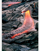
A lava flow type called pahoehoe--smooth, unbroken lava--at Kilauea.
Credit: Pete Mouginis-Mark, University of Hawaii
Download the high-resolution JPG version of the image. (345 KB)
Use your mouse to right-click (Mac users may need to Ctrl-click) the link above and choose the option that will save the file or target to your computer.

Aerial photo of Puu Oo cinder-and-spatter cone on the east rift zone of Kilauea.
Credit: Pete Mouginis-Mark, University of Hawaii
Download the high-resolution JPG version of the image. (319 KB)
Use your mouse to right-click (Mac users may need to Ctrl-click) the link above and choose the option that will save the file or target to your computer.
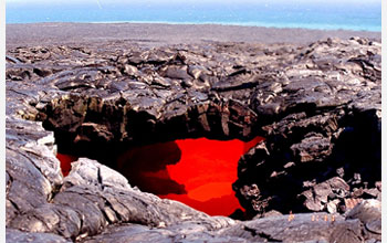
This photo shows a "lava skylight" at Kilauea.
Credit: Pete Mouginis-Mark, University of Hawaii
Download the high-resolution JPG version of the image. (275 KB)
Use your mouse to right-click (Mac users may need to Ctrl-click) the link above and choose the option that will save the file or target to your computer.

An ocean-bottom seismometer package: green = seismometer, yellow = acquisition system.
Credit: Gabi Laske, Scripps Institution of Oceanography
Download the high-resolution JPG version of the image. (1.6 MB)
Use your mouse to right-click (Mac users may need to Ctrl-click) the link above and choose the option that will save the file or target to your computer.
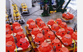
On deck are the components of the seismometer acquisition packages.
Credit: Gabi Laske, Scripps Institution of Oceanography
Download the high-resolution JPG version of the image. (1.8 MB)
Use your mouse to right-click (Mac users may need to Ctrl-click) the link above and choose the option that will save the file or target to your computer.

The researchers' findings appear in the December 4, 2009, issue of the journal Science.
Credit: Copyright 2009 AAAS
Download the high-resolution JPG version of the image. (71 KB)
Use your mouse to right-click (Mac users may need to Ctrl-click) the link above and choose the option that will save the file or target to your computer.