
All Images
News Release 18-053
Scientists use satellites to measure vital underground water resources
Latest space technology allows looks beneath Earth’s surface
This material is available primarily for archival purposes. Telephone numbers or other contact information may be out of date; please see current contact information at media contacts.

California's Central Valley, with the rugged hills of the Coast Ranges.
Credit: Wikimedia Commons
Download the high-resolution JPG version of the image. (269.7 KB)
Use your mouse to right-click (Mac users may need to Ctrl-click) the link above and choose the option that will save the file or target to your computer.
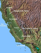
Map showing California's Central Valley, which runs through a large part of the state.
Credit: Wikimedia Commons
Download the high-resolution JPG version of the image. (58.9 KB)
Use your mouse to right-click (Mac users may need to Ctrl-click) the link above and choose the option that will save the file or target to your computer.
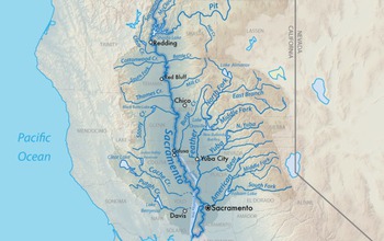
The Sacramento River and its watershed are part of the Central Valley.
Credit: Wikimedia Commons
Download the high-resolution PNG version of the image. (938.8 KB)
Use your mouse to right-click (Mac users may need to Ctrl-click) the link above and choose the option that will save the file or target to your computer.
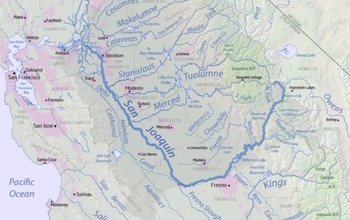
The San Joaquin River and its watershed are also part of the Central Valley.
Credit: Wikimedia Commons
Download the high-resolution PNG version of the image. (876.6 KB)
Use your mouse to right-click (Mac users may need to Ctrl-click) the link above and choose the option that will save the file or target to your computer.
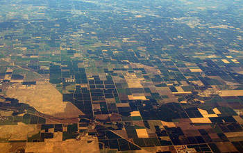
Much of the Central Valley has been modified by agriculture and other human uses.
Credit: Wikimedia Commons
Download the high-resolution JPG version of the image. (119.2 KB)
Use your mouse to right-click (Mac users may need to Ctrl-click) the link above and choose the option that will save the file or target to your computer.
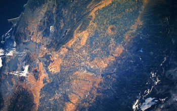
The Central Valley, viewed from space.
Credit: NASA
Download the high-resolution JPG version of the image. (4.6 MB)
Use your mouse to right-click (Mac users may need to Ctrl-click) the link above and choose the option that will save the file or target to your computer.