

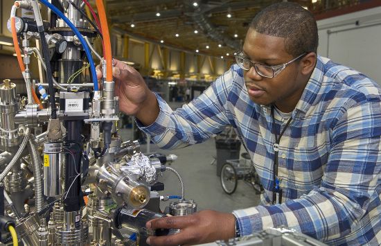
The U.S. National Science Foundation supports significant research infrastructure, including facilities, aircraft and ships, that provide state-of-the-art assets to the geoscience community.
NSF-supported infrastructure enables groundbreaking science and inspires collaboration across disciplines. This page includes infrastructure managed by the NSF Office of Research Infrastructure (NSF ORI) and NSF Directorate for Geosciences (NSF GEO).
 On this page
Atmospheric and geospace sciences
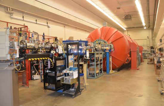
NSF National Center for Atmospheric Research
The NSF National Center for Atmospheric Research (NSF NCAR) is a Federally Funded Research and Development Center in Boulder, Colorado. It is a focal point for research in the field of atmospheric science and hosts approximately 750 scientists and support personnel.
NCAR is managed by NSF ORI under a cooperative agreement between NSF and the University Corporation for Atmospheric Research, a nonprofit consortium of North American universities with graduate programs in atmospheric sciences.
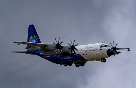
NSF NCAR C-130 aircraft
The NSF NCAR C-130 is a medium-sized utility aircraft ideal for studies of the planetary boundary layer and middle and lower troposphere.
In a typical research configuration, the aircraft can carry 13,000 pounds of payload and fly for 8 to 9 hours. It can also extend a ramp mid-flight to allow deployment of specialized equipment like ocean buoys.
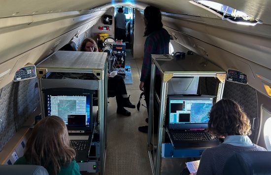
NSF NCAR HIAPER Gulfstream GV
The NSF NCAR High-performance Instrumented Airborne Platform for Environmental Research (NSF NCAR HIAPER) aircraft is a mid-sized research platform for scientists studying air quality and chemistry, atmospheric dynamics and cloud properties, among other topics.
It can carry 5,600 pounds of payload and fly at higher altitudes for approximately 9 hours for typical research configurations. The aircraft can collect in-situ and remote-sensing data and deploy expendable instruments.
NSF NCAR airborne instrumentation
NSF NCAR hosts instruments that are available to deploy on either or both of the NSF NCAR GV or C-130 aircraft. The instruments measure in situ wind, temperature and moisture fields; cloud and precipitation particles; aerosol; gas and radiation.
Radar and lidar remote sensing and the AVAPS Dropsonde System are also available to provide broader atmospheric measurements.
NSF NCAR Integrated Sounding System
The NSF NCAR Integrated Sounding System (ISS) is a dynamic meteorological observing system that combines surface, sounding and remote-sensing instruments to capture a comprehensive description of lower atmospheric thermodynamics and winds.
NSF NCAR Integrated Surface Flux System
The NSF NCAR Integrated Surface Flux System (ISFS) is a site with resources to study how the atmosphere interacts with the Earth's surface.
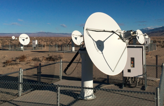
NSF NCAR S-band Dual Polarization Doppler Radar
The NSF NCAR S-band Dual Polarization Doppler Radar (S-Pol) is a research-grade, transportable, ground-based and dual-polarized doppler weather radar.
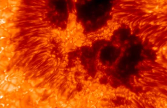
NSF NCAR Mauna Loa Solar Observatory
The NSF NCAR Mauna Loa Solar Observatory monitors the sun's atmosphere to study the sun-Earth system and to provide observations to reduce damage and disruption from space weather hazards.
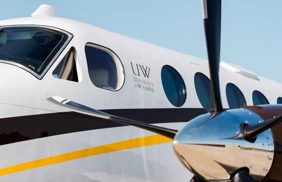
NSF Wyoming King Air research aircraft
The NSF Wyoming King Air is a relatively small and lightweight aircraft that supports research projects on atmospheric chemistry, cloud physics, aerosols, air quality and energy exchange between the surface of the Earth and its lower atmosphere.
Under a typical research configuration, it can carry 16,500 pounds and fly for up to 4 hours. The King Air is managed under a cooperative agreement with the University of Wyoming and was updated with new and improved sensors and equipment in September 2024.
Other NSF-supported facilities for atmospheric science
NSF GEO funds radars, remote-sensing suites and laboratory facilities based at various institutions through the Atmospheric and Geospace Sciences Community Instruments and Facilities program:
Weather radars
UAH FARM
The University of Alabama in Huntsville (UAH) Flexible Array of Radars and Mesonets (FARM) includes multiple radars and surface weather instrumentation.
OU RaXPol
The Rapid X-band Polarimetric Radar (RaXPol) at The University of Oklahoma (OU) is a truck-based platform that can quickly capture radar measurements during severe weather.
CSU SEA-POL radar
The Sea-Going and Land Deployable Polarimetric (SEA-POL) Radar at Colorado State University (CSU) can take weather radar measurements on a ship in rough seas or on land in strong winds.
In situ observations
MUSAS
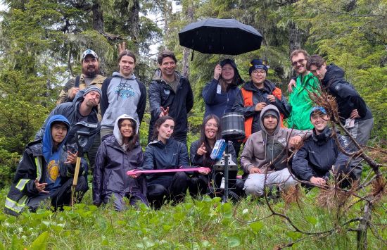
The Mobile Unscrewed Systems for Atmospheric Science (MUSAS) facility is used in the study of boundary layer processes, coastal circulations, aerosol processes, turbulence and turbulent fluxes, surface-atmosphere exchange, high-latitude environments and severe weather.
Remote-sensing suites
The Multi-function Airborne Raman Lidar (MARLi) and Airborne Doppler Lidar (ADL)
The MARLi and ADL instruments provide simultaneous water vapor, temperature, wind, aerosol and cloud profiles within the Planetary Boundary Layer (PBL). MARLi and ADL are managed by NSF ORI.
UW–Madison SPARC
The University of Wisconsin-Madison Space Science and Engineering Center Portable Atmospheric Research Center (SPARC) is a mobile research laboratory with remote-sensing instruments that provide vertical profiles of temperature, wind, moisture, clouds and aerosols.
UAH Mobile Atmospheric Profiling Network (MAPNet)
The University of Alabama in Huntsville (UAH) Mobile Atmospheric Profiling Network (MAPNet) provides wind, thermodynamic, aerosol and precipitation measurements for the study of severe weather and air quality.
Laboratory facilities
Single Particle Soot Photometer
The Single Particle Soot Photometer (SP2) at Clemson University measures black carbon in the atmosphere to better understand the particle's effects on variables like cloud formation and local heating. The SP2 can also be deployed in the field.
Pi Cloud Chamber
The Pi Cloud Chamber at Michigan Technological University can generate clouds under various conditions for long-term observations.
Storm Peak Laboratory
The Storm Peak Laboratory at The University of Utah is a mountain-top facility that allows researchers to conduct long-term studies on weather processes.
Geospace facilities managed by NSF GEO:

Big Bear Solar Observatory
The New Jersey Institute of Technology operates the Big Bear Solar Observatory (BBSO) on the north side of Big Bear Lake in Southern California. The observatory includes the Goode Solar Telescope, which allows researchers to observe the sun.
Expanded Owens Valley Solar Array
The New Jersey Institute of Technology operates the Expanded Owens Valley Solar Array (EOVSA) in east-central California. The astronomical radio telescope is positioned to face the sun so researchers can study solar physics.
Simpson Neutron Monitor Array
The Universities of New Hampshire, Delaware and Wisconsin-River Falls operate the Simpson Neutron Monitor Array, a ground-based cosmic ray monitor to detect and measure high-energy space radiation and its variation on the ground in relation to the sun's activity.
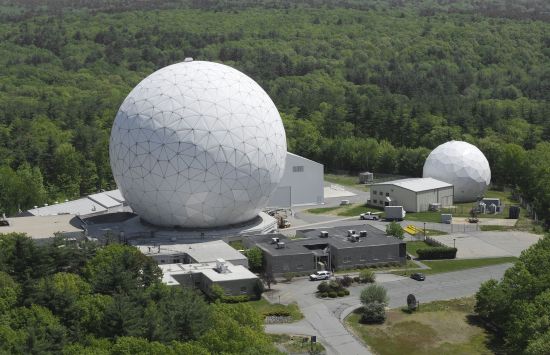
Millstone Hill Geospace Observatory
The Massachusetts Institute of Technology operates the Millstone Hill Geospace Observatory (MHGO) at the Haystack Observatory complex in Massachusetts. MHGO includes a cluster of radio, radar and distributed instruments used to explore Earth's upper atmosphere.
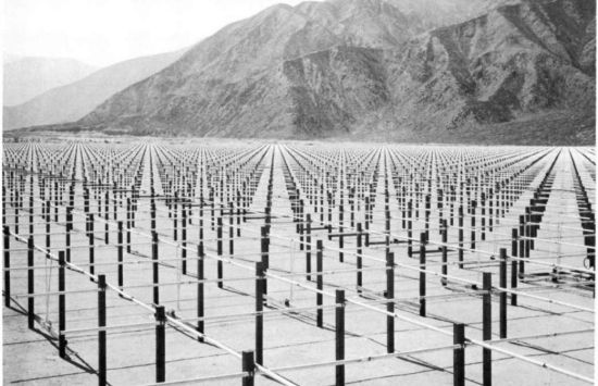
Jicamarca Radio Observatory
Cornell University, in collaboration with the Peruvian Geophysical Institute (Instituto Geofísico del Perú), manages a radio antenna array to study the Earth's upper atmosphere.
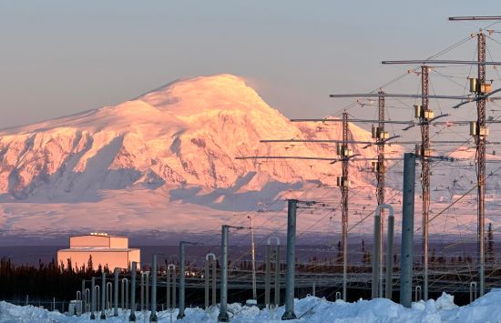
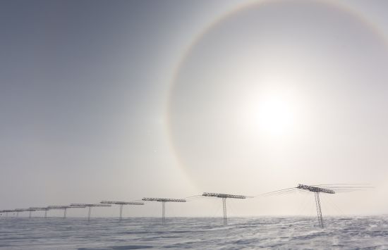
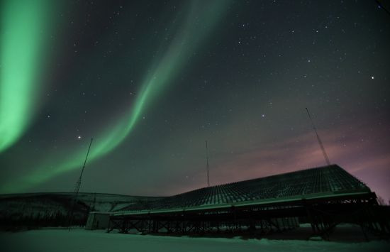
Subauroral Geophysical Observatory
The University of Alaska operates the Subauroral Geophysical Observatory for Space Physics and Radio Science (SAGO) as part of the High-frequency Active Auroral Research Program which uses high-powered radio waves to study how the ionosphere interacts with them.
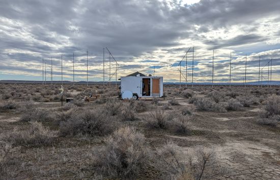
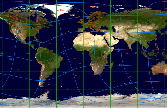
Super Dual Auroral Radar Network
The Super Dual Auroral Radar Network (SuperDARN) is a global scientific radar network that includes high-frequency radars to study phenomena in the Earth's upper atmosphere and magnetosphere, like space weather.
Various institutions host the network, including Dartmouth College in New Hampshire and Virginia Tech.
Midlatitude Allsky-imaging Network for GeoSpace Observations
SRI International and the University of Illinois operate the Midlatitude Allsky-imaging Network for GeoSpace Observations (MANGO), in collaboration with the University of California, Berkely.
MANGO is a network of all-sky cameras and Fabry-Perot Interferometers to observe wave activity in the thermosphere.
Surface Magnetic Assessment in Real Time Magnetometer Network
The University of California, Los Angeles, operates the Surface Magnetic Assessment in Real Time (SMART) Magnetometer Network, a system of ground-based magnetometers across the country. The magnetometers measure and monitor space weather phenomena.
SuperMAG
SuperMAG is an international collaboration to analyze long-term data from over 600 ground-based magnetometers. Johns Hopkins University Applied Physics Lab manages the NSF-supported part of the project.
AMPERE
Johns Hopkins University Applied Physics Lab manages the Active Magnetosphere and Planetary Electrodynamics Response Experiment (AMPERE), which provides magnetic data collected by satellites to conduct research in magnetosphere-ionosphere physics.
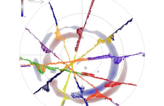
Advanced Modular Incoherent Scatter Radar
Operated by SRI International, the Advanced Modular Incoherent Scatter Radar (AMISR) consists of two phased-array radar systems used to study processes in the ionosphere. One system is in Poker Flat, Alaska, and the other is in Resolute Bay, Canada.
Earth sciences
Earth sciences infrastructure managed by NSF ORI:
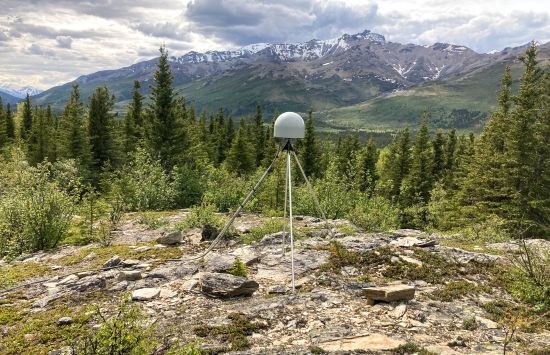
NSF National Geophysical Facility
The EarthScope Consortium operates the NSF National Geophysical Facility (NSF NGF). The facility ensures the U.S. is at the forefront of using geodesy and seismology to study the deformation of the Earth's surface and address questions about the Earth's structure, evolution and dynamics.
The new facility, as of summer 2025, will help researchers study and prepare for natural hazards, manage resources and enhance national security.
Earth sciences infrastructure managed by NSF GEO:

NSF Facility for Open Research in a Compressed Environment
Arizona State University hosts the NSF Facility for Open Research in a Compressed Environment (NSF FORCE) to study matter at extremely high pressure and high temperatures under conditions of compression and stress.
NSF Synchrotron Earth and Environmental Science
The University of Chicago manages the NSF Synchrotron Earth and Environmental Science (NSF SEES), which supports researchers who study geologic materials using X-ray radiation.
NSF SEES is responsible for the management, operation and development of multiple user facilities hosted at four U.S. Department of Energy-operated synchrotrons, or particle accelerators: Advanced Photon Source, Advanced Light Source, National Synchrotron Light Source II and Stanford Synchrotron Radiation Lightsource.
Continental Scientific Drilling
The University of Minnesota operates the NSF Continental Scientific Drilling (NSF CSD) facility. The facility supports researchers whose work requires drilling, coring and subsurface surveys on land and in lakes.

International Continental Drilling Program
The U.S. is a founding member of the International Continental Drilling Program, which works with scientists to plan large, collaborative projects on land and in lakes around the world.
These projects investigate topics in Earth and environmental science, including geological hazards and resources, geodynamic processes and environmental change. NSF GEO supports the program through a memorandum of understanding.
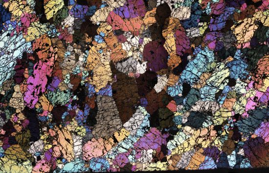
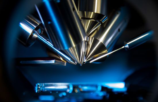
Secondary-ion mass spectrometry resources
The Woods Hole Oceanographic Institution, University of Wisconsin-Madison and University of California, Los Angeles host secondary-ion mass spectrometry (SIMS) instruments that allow researchers to map Earth materials at microscale.
SIMS provides measurements of isotopic ratios and trace element abundance in minerals and the three SIMS user facilities provide complementary capabilities and technique development activities to support studies in the Earth and ocean sciences.
Institute for Rock Magnetism
The University of Minnesota manages the Institute for Rock Magnetism (IRM), which maintains a suite of specialized instruments and technical expertise to support interdisciplinary research related to rock and mineral magnetism.
Cosmogenic and radionuclide analyses
The Purdue Rare Isotope Measurement Laboratory (PRIME) and University of Vermont Community Cosmogenic Facility (CCF) collaborate to help researchers use accelerator mass spectrometry on the Earth's surface materials to measure alteration from cosmic rays and date past geologic events.
Arizona LaserChron Center
The University of Arizona operates the Arizona LaserChron Center (ALC), which provides tools to analyze geologic samples. Researchers can apply the precise U-Th-Pb radiometric dating technique to determine a sample’s geochronologic record.
They can also gather geochemical information using laser ablation inductively coupled plasma mass spectrometry, also known as LA-ICP-MS, to gather highly sensitive elemental and isotopic information about samples.
Center for Transformative Environmental Monitoring Programs
The Center for Transformative Environmental Monitoring Programs (CTEMPS) facility, operated across four academic and research institutions, provides a suite of environmental monitoring instrumentation and training for studying critical zone processes.
Ocean sciences
Ocean sciences infrastructure managed by NSF ORI:
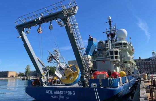

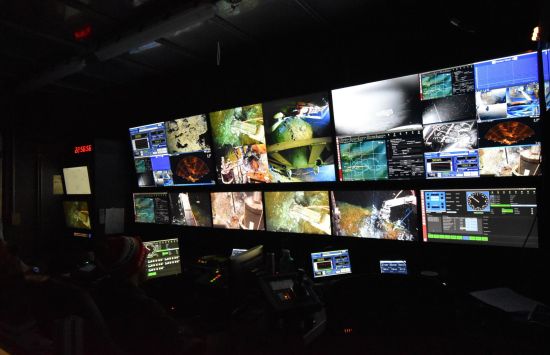
U.S. Academic Research Fleet
The U.S. Academic Research Fleet (ARF) comprises 16 oceanographic vessels, along with submersibles and autonomous systems that access the seafloor and sub-seafloor across the global ocean, the Great Lakes and remote polar regions. Fleet assets are owned by NSF, the Office of Naval Research, the National Oceanic and Atmospheric Administration and U.S. academic institutions and are operated by research universities and laboratories.
These technologically advanced ships, submersibles and autonomous vehicles enable the collection of critical observational data on Earth systems. Through at-sea sampling and sustained observations, researchers are improving the ability to understand, model and predict how marine ecosystems respond to both episodic and long-term changes in ocean conditions.
Regional Class Research Vessels (RCRV): (Coming soon) A trio of ships that will modernize and support the U.S. Academic Research Fleet. Each RCRV will be a floating laboratory for ocean-going scientists, capable of precise station-keeping for water column and sediment sampling and supporting remotely operated and autonomous vehicles. The vessels will also allow shore-based scientists to virtually participate in ship-based activities, greatly expanding the potential user base.
- R/V Taani will be the first to complete construction. Oregon State University will operate the vessel on the West Coast.
- R/V Narragansett Dawn will follow the R/V Taani. The East Coast Oceanographic Consortium led by the University of Rhode Island will operate the vessel on the East Coast.
- R/V Gilbert R. Mason will be the final vessel to complete construction. The Gulf-Caribbean Oceanographic Consortium will operate the vessel in the Gulf of Mexico and nearby waters.
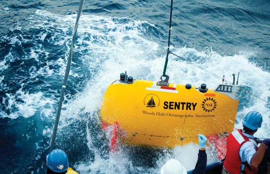
National Deep Submergence Facility
NSF funds the Woods Hole Oceanographic Institute to host and operate a fleet of underwater vehicles to explore, sample and map the deep ocean. The vehicles are owned by the National Oceanic and Atmospheric Administration and the Office of Naval Research. The fleet includes:
- HOV Alvin - Alvin is a human-occupied vehicle (HOV) that enables data collection and observation by two scientists and can reach depths of 6,500 meters during dives that can last up to 10 hours.
- ROV Jason - Jason is a remotely operated vehicle (ROV) that allows scientists to have access to the seafloor without leaving the deck of a ship.
- AUV Sentry - Sentry is an autonomous underwater vehicle (AUV) capable of exploring the ocean down to 6,000 meters.
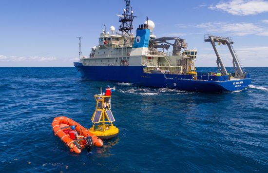
NSF Ocean Observatories Initiative
The NSF Ocean Observatories Initiative (NSF OOI) delivers real-time data from five ocean-based arrays of more than 900 instruments. NSF OOI advances the study of ocean processes like the relationship between the high-latitude North Atlantic and the global carbon cycle.
Researchers also rely on these instruments to monitor underwater volcanoes and earthquakes, which can trigger tsunamis with 100-foot waves. Use the comprehensive and free data explorer to look for information by location and instrument, among other topics.
NSF Global Ocean Biogeochemistry Array
This global robotic network includes autonomous robotic floats with instruments to monitor the ocean.
Ocean sciences infrastructure managed by NSF GEO:

NSF Scientific Ocean Drilling Coordinating Office and Sub-Seafloor Sampling Program
Researchers rely on scientific ocean drilling and sub-seafloor sampling to study the Earth's history at remote locations.
The NSF Scientific Ocean Drilling Coordinating Office (NSF SODCO) helps scientists conduct research on geologic history and hazards, deep-ocean life and sub-seafloor carbon sequestration. These programs replace the former International Ocean Discovery Program (IODP).
Polar sciences
The NSF Office of Polar Programs (NSF OPP) supports innovative and creative scientific research relating to the Earth's polar regions and the global interplay of these regions with other regions across the planet. NSF OPP sits within the NSF Office of the Director.