All Images
News Release 14-067
California Central Valley groundwater depletion slowly raises Sierra Nevada mountains
Changes may trigger small earthquakes, scientists find
This material is available primarily for archival purposes. Telephone numbers or other contact information may be out of date; please see current contact information at media contacts.

Water in Southern California's Great Valley flows along the California Aqueduct.
Credit: Bill Hammond
Download the high-resolution JPG version of the image. (232.0 KB)
Use your mouse to right-click (Mac users may need to Ctrl-click) the link above and choose the option that will save the file or target to your computer.

The NSF EarthScope Plate Boundary Observatory GPS network is providing millimeter-precision data.
Credit: NSF EarthScope Program
Download the high-resolution JPG version of the image. (407.3 KB)
Use your mouse to right-click (Mac users may need to Ctrl-click) the link above and choose the option that will save the file or target to your computer.

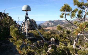
The GPS station that's part of the NSF Plate Boundary Observatory is pictured on a Nevada summit.
Credit: Bill Hammond
Download the high-resolution JPG version of the image. (2.2 MB)
Use your mouse to right-click (Mac users may need to Ctrl-click) the link above and choose the option that will save the file or target to your computer.

The Sierra Nevada has gone through kilometers of rock uplift over the last several million years.
Credit: Bill Hammond
Download the high-resolution JPG version of the image. (595.4 KB)
Use your mouse to right-click (Mac users may need to Ctrl-click) the link above and choose the option that will save the file or target to your computer.

GPS station 311 in the Eastern Sierra Nevada, part of the NSF Plate Boundary Observatory.
Credit: UNAVCO
Download the high-resolution JPG version of the image. (1.1 MB)
Use your mouse to right-click (Mac users may need to Ctrl-click) the link above and choose the option that will save the file or target to your computer.

Waning snowpack on the crest of the Sierra Nevada's Twin Peaks, near the Pacific Crest Trail.
Credit: Bill Hammond
Download the high-resolution JPG version of the image. (1.9 MB)
Use your mouse to right-click (Mac users may need to Ctrl-click) the link above and choose the option that will save the file or target to your computer.


